Файл:Carolingian empire 814.svg
Перейти к навигации
Перейти к поиску

Размер этого PNG-превью для исходного SVG-файла: 619 × 599 пкс. Другие разрешения: 248 × 240 пкс | 496 × 480 пкс | 793 × 768 пкс | 1058 × 1024 пкс | 2116 × 2048 пкс | 1092 × 1057 пкс.
Исходный файл (SVG-файл, номинально 1092 × 1057 пкс, размер файла: 237 КБ)
Этот файл находится на Викискладе. Сведения о нём показаны ниже.
Викисклад — централизованное хранилище для свободных файлов, используемых в проектах Викимедиа.
|
Краткое описание
| Описание |
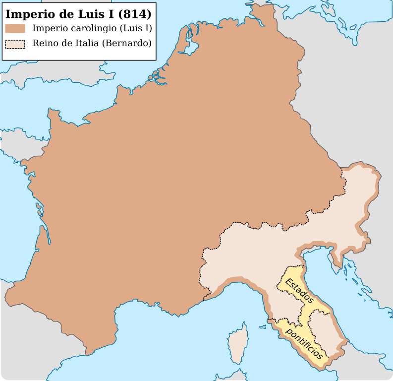
Español: Imperio carolingio al ascenso del emperador Luis I (814) |
| Дата | |
| Источник |
Собственная работа
|
| Автор | Trasamundo |
| Другие версии |
|


Лицензирование
Я, владелец авторских прав на это произведение, добровольно публикую его на условиях следующих лицензий:

|
Разрешается копировать, распространять и/или изменять этот документ в соответствии с условиями GNU Free Documentation License версии 1.2 или более поздней, опубликованной Фондом свободного программного обеспечения, без неизменяемых разделов, без текстов, помещаемых на первой и последней обложке. Копия лицензии включена в раздел, озаглавленный GNU Free Documentation License. |
Этот файл доступен на условиях лицензий Creative Commons Attribution-Share Alike 3.0 Unported, 2.5 Generic, 2.0 Generic и 1.0 Generic.
- Вы можете свободно:
- делиться произведением – копировать, распространять и передавать данное произведение
- создавать производные – переделывать данное произведение
- При соблюдении следующих условий:
- атрибуция – Вы должны указать авторство, предоставить ссылку на лицензию и указать, внёс ли автор какие-либо изменения. Это можно сделать любым разумным способом, но не создавая впечатление, что лицензиат поддерживает вас или использование вами данного произведения.
- распространение на тех же условиях – Если вы изменяете, преобразуете или создаёте иное произведение на основе данного, то обязаны использовать лицензию исходного произведения или лицензию, совместимую с исходной.
Вы можете выбрать любую из этих лицензий.
История файла
Нажмите на дату/время, чтобы посмотреть файл, который был загружен в тот момент.
| Дата/время | Миниатюра | Размеры | Участник | Примечание | |
|---|---|---|---|---|---|
| текущий | 12:01, 28 октября 2021 | | 1092 × 1057 (237 КБ) | Rowanwindwhistler | minor change in sea lines so hide them in the frame side |
| 11:59, 28 октября 2021 |  | 1092 × 1057 (235 КБ) | Rowanwindwhistler | Lighter colours, fake text added for better rendering in articles (real text is now hidden). | |
| 08:29, 4 мая 2016 |  | 1091 × 1053 (185 КБ) | Rowanwindwhistler | Softer colours, bigger font size | |
| 22:03, 22 апреля 2016 |  | 1091 × 1053 (185 КБ) | Rowanwindwhistler | Cleaner shapes, some colours from https://en.wikipedia.org/wiki/Wikipedia:WikiProject_Maps/Conventions | |
| 18:24, 13 марта 2010 |  | 1091 × 1053 (734 КБ) | Trasamundo | {{Information |Description={{es|1=Imperio carolingio al ascenso del emperador Luis I (814)}} |Source={{own}} |Author=Trasamundo |Date=13 March 2010 |Permission= |other_versions= }} Category:Maps of the Carolingian Empire |
Использование файла
Нет страниц, использующих этот файл.
Глобальное использование файла
Данный файл используется в следующих вики:
- Использование в ast.wikipedia.org
- Использование в en.wikipedia.org
- Использование в es.wikipedia.org
- Использование в gl.wikipedia.org
- Использование в it.wikipedia.org
- Использование в zh.wikipedia.org