Файл:Croatian Prevlaka in occupation by Montenegro and Serbia.jpg
Перейти к навигации
Перейти к поиску
Нет версии с бо́льшим разрешением.
Croatian_Prevlaka_in_occupation_by_Montenegro_and_Serbia.jpg (760 × 560 пкс, размер файла: 118 КБ, MIME-тип: image/jpeg)
Этот файл находится на Викискладе. Сведения о нём показаны ниже.
Викисклад — централизованное хранилище для свободных файлов, используемых в проектах Викимедиа.
|
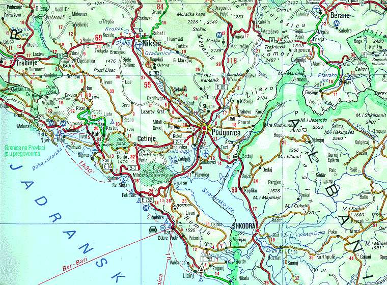
| Описание | Map of Montenegrin Littoral Region and Boka kotorska in the time of occupation of Croatian Prevlaka Region which is the remaining part of Boka kotorska that belongs to Croatia. | |||
| Дата | 1991-2002 (occupation ended 1992-10-20 at 20:30) (UNMIK mission ended 2002-12-20). | |||
| Источник | Ministry of Foreign Affairs of the State Union Serbia and Montenegro (before that MFA of Federal Republic of Yugoslavia | |||
| Автор | Serbian Official Cartography (Public Service at the time). | |||
| Права (Повторное использование этого файла) |
|
|||
| Другие версии | Geographical version. |

История файла
Нажмите на дату/время, чтобы посмотреть файл, который был загружен в тот момент.
| Дата/время | Миниатюра | Размеры | Участник | Примечание | |
|---|---|---|---|---|---|
| текущий | 02:05, 16 февраля 2008 | | 760 × 560 (118 КБ) | Imbris~commonswiki | {{Information |Description=Map of Montenegrin ''Littoral Region'' and ''Boka kotorska'' in the time of occupation of Croatian hr:Prevlaka Region which is the remaining part of Boka kotorska that belongs to Croatia. |Source=[http://www.mfa.gov.yu/Fact |
Использование файла
Следующая страница использует этот файл:
Глобальное использование файла
Данный файл используется в следующих вики:
- Использование в ca.wikipedia.org
- Использование в ckb.wikipedia.org
- Использование в de.wikipedia.org
- Использование в en.wikipedia.org
- Использование в fa.wikipedia.org
- Использование в hr.wikipedia.org
- Использование в id.wikipedia.org
- Использование в mzn.wikipedia.org
- Использование в nl.wikipedia.org
- Использование в sh.wikipedia.org
- Использование в sq.wikipedia.org
- Использование в www.wikidata.org
- Использование в zh.wikipedia.org